
Phase 3B: Policy Framework (Winter 2017)
After a series of Community Dialogues and a summer of engagement the public at street festivals, City staff worked with the Topical Research Teams to incorporate engagement feedback into policy statements, and draft comprehensive plan policy. After incorporating feedback into the revised draft policy staff still had questions around how growth policies will be applied throughout the city which needed public feedback.
Throughout 2017, City staff learned a lot from Minneapolis residents about their vision for the future of the city. Staff heard that not everyone has the choice and access to the type of housing that meets their needs, and are unable to shop for groceries near their home, especially without a car. Additionally, staff also heard that there is a desire for the city to be more walkable, bikeable, and mass transit-friendly. City staff proposed some ideas on how to achieve this, and asked the public to comment and identify places in the city to expand these opportunities. The main objectives of Phase 3B engagement were to:
- Report back on what was heard during Phase 3A
- Reaffirm the feedback by providing supporting information and context
- Seek feedback on draft policy directions, and how to apply them geographically to expand opportunities for housing, jobs and improve connectivity
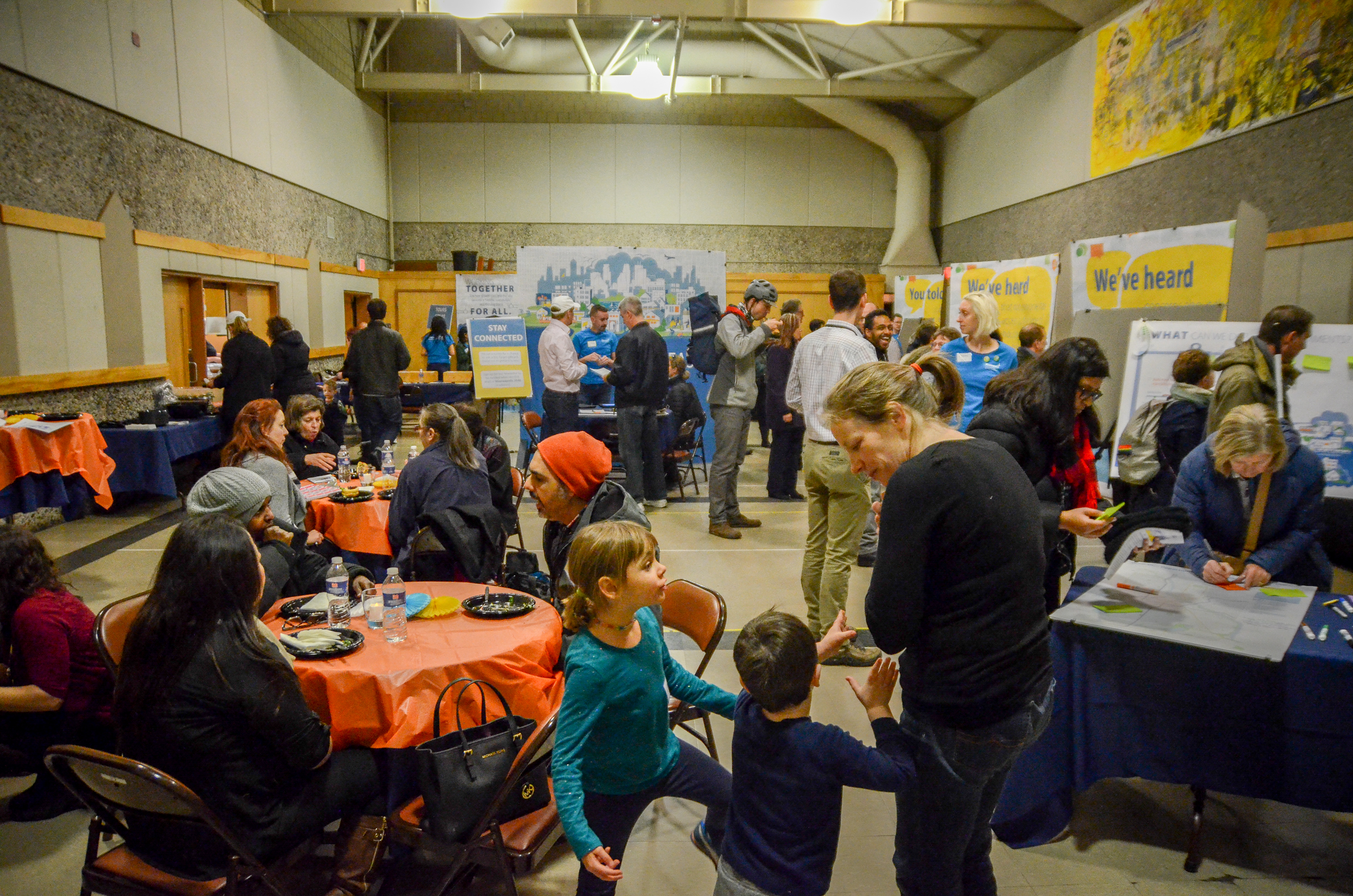
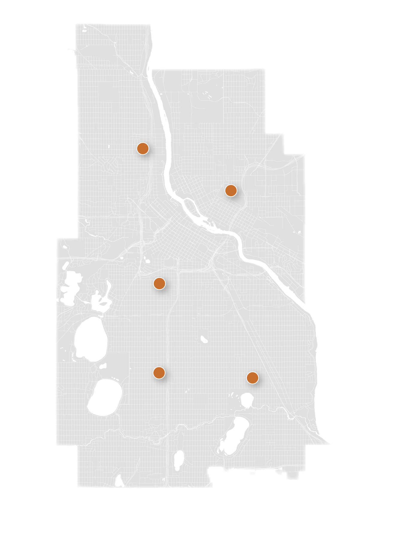
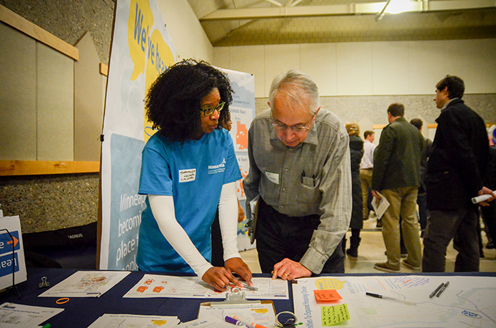
The City hosted open houses in each of the five planning sectors of the city. Staff partnered with neighborhood organizations to host these meetings and conduct outreach to residents. Artist Monica sheets collaborated with staff to design engagement activities that were fun, engaging, and family-friendly.
Phase 3B engagement started at the end of November 2017 with the release of online engagement activities which included a parallax – an online story-telling tool which images and text for people to scroll through and provide feedback, Make a Map – an online mapping tool, and the an updated Meeting-in-a-Box for Phase 3B.
Engagement Activities
|
East Open House North Open House South Open House Southwest Open House |
Downtown Open House Online Parallax Make a Map (Maptionnaire) Phase 3B Meeting-in-a-Box (Host Packet and Participant Packet) |
Engagement Questions – Phase 3B

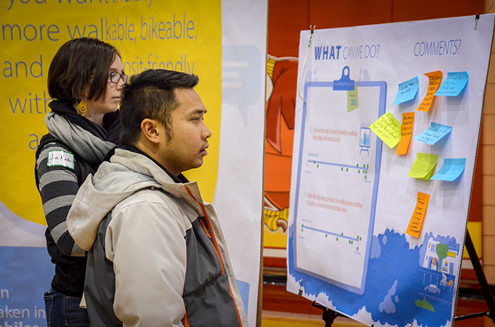
Activities for Phase 3B were organized in a way to guide users through prior engagement efforts, and how the feedback that has been collected has informed decisions and policy in subsequent phases. Content was divided into areas of focus for the comprehensive plan: housing, retail, streets, complete communities, and climate change. Participants were prompted with feedback that was collected, and were provided ideas on what the City can do to meet the comprehensive plan goals.
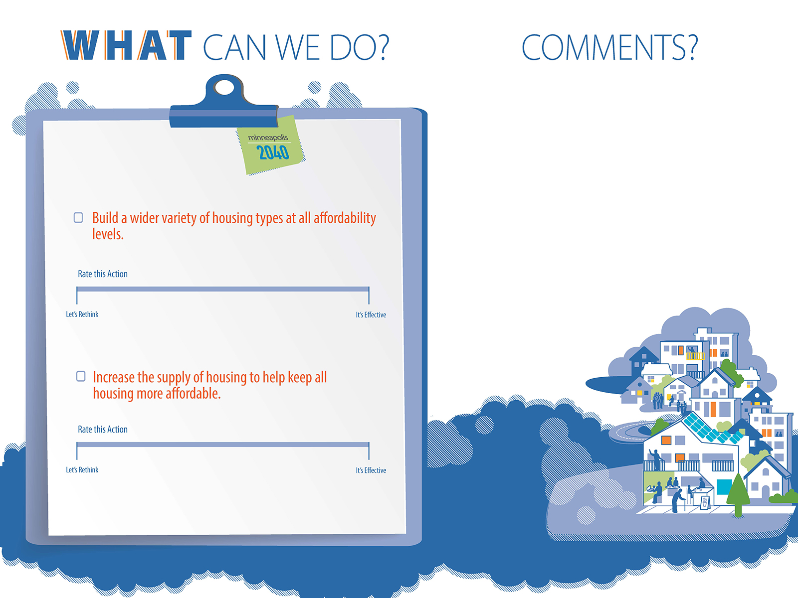
Engagement during Phase 3B asked participants to reflect on proposed ideas and their effectiveness in achieving the goals for the comprehensive plan. Participants were asked to rate these proposed ideas on a scale ranging from a rating of “It’s Effective” to “Let’s Rethink”. Participants were asked to explain their rating through a comment.
Below are the proposed ideas organized by topical areas:
- Housing
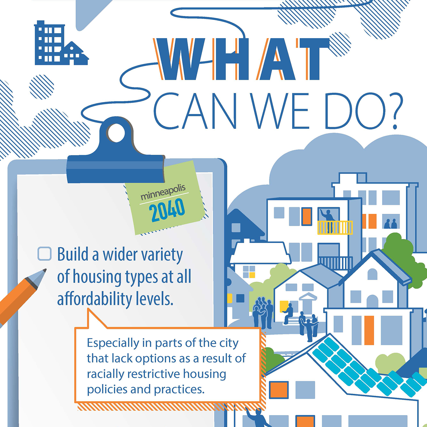
- Build a wider variety of housing types at all affordability levels.
- Increase the supply of housing to help keep all housing more affordable.
- Retail
- As jobs increase, make sure we have enough places for new businesses close to where Minneapolis residents live.
- Provide better mass transit to places of employment.
- Streets
- Ensure the city's streets prioritize walking, bicycling, and mass transit.
- Make the city more pleasant for walking and continue to build a system of protected bike lanes.
- Complete Communities
- Build more housing, retail, and places for employment, especially near mass transit.
- Ensure people can get goods and services close to where they live by building more stores in under-served areas.
- Climate Change
- Retrofit existing buildings to reduce energy consumption and dependency on fossil fuels.
- Ensure that new buildings are as energy efficient as possible.
An integral part of feedback was on where to apply these proposed ideas geographically in the city. In online and in-person interactions the public were provided three different maps to identify opportunities to expand housing, jobs and retail, and improve connectivity. The questions that accompanied these maps are:
- Show us…opportunities to expand housing choice. Please identify locations to expand housing choice and tell us why.
- Show is…opportunities to improve access to retail. Please identify locations to expand retail access and tell us why.
- Show us…opportunities to expand connectivity via walking, biking, and transit. Please identify locations to expand connectivity via walking, biking, and transit.
Methods– Phase 3B
- Parallax – an online story-telling tool which images and text for people to scroll through and provide feedback. Staff utilized this tool to inform the public, and update new participants, of the work that has been done to date. Users were prompted with feedback collected from engagement, and supporting information and data. For those who were interested in learning more about the supporting information links were provided to maps and resources. As the user navigated through the parallax they were given the proposed ideas and were asked to rate those ideas and provide comments. The parallax was adapted for materials for the updated Meeting-in-a-Box, online engagement materials, and the open houses.
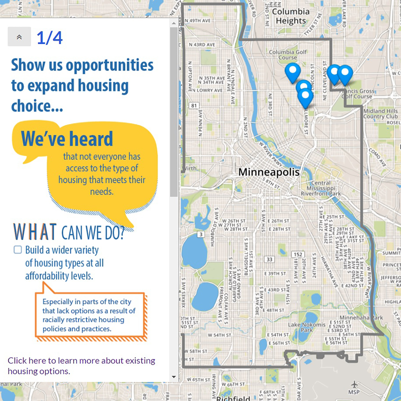
- Make a Map (maptionnaire) – Maptionnaire is an online mapping tool used for gathering engagement feedback. The City utilized this tool to provide the public with an opportunity to identify opportunities to expand housing choice, access retail, and expand connectivity by draw shapes, lines, and points on a map. For each data point drawn users were encouraged to explain why they selected that location.
- Meeting-in-a-Box – Meeting-in-a-Box was updated for Phase 3B with questions and maps from the parallax. This included maps which asked participants to identify places in the city to expand opportunities for housing, jobs and retail, and improve connectivity.
What did we hear? – Phase 3B
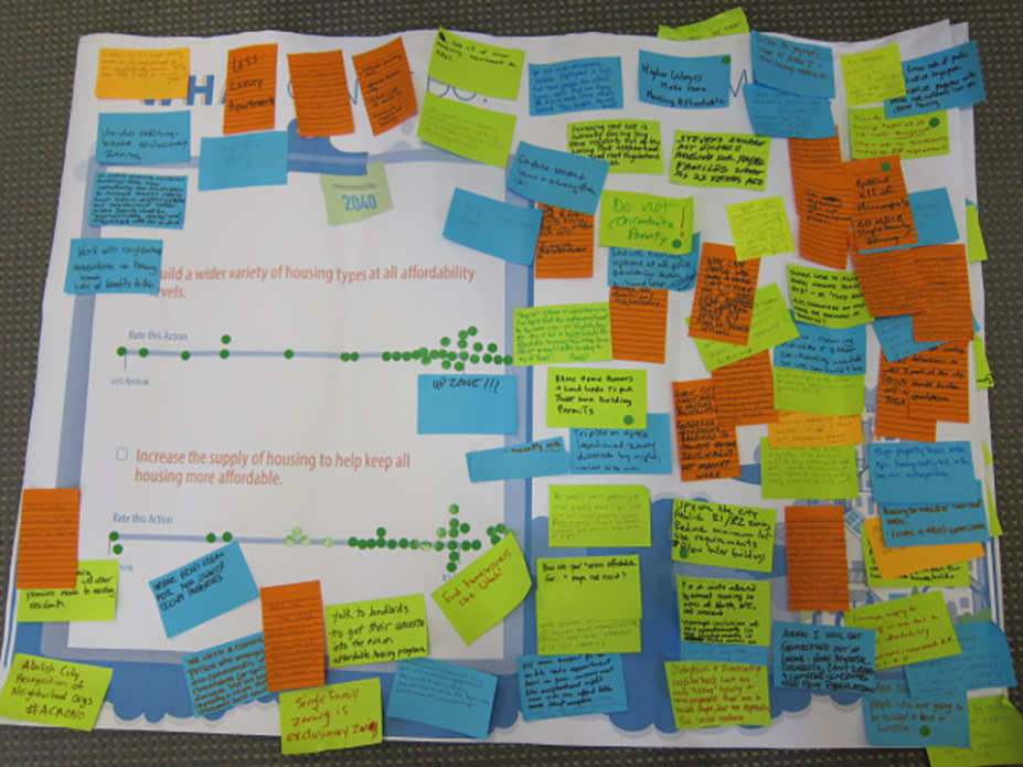
Much of the questions around engagement was centered on the effectiveness of the proposed ideas in achieving the comprehensive plan goals. There was general support of most of the proposed ideas and their effectiveness. Comments from the Rate This Action exercise reaffirmed the need to preserve affordable housing, as well as build more of it throughout all neighborhoods in the city. There was also the reoccurring theme of increasing housing opportunities for all residents by allowing more ‘missing middle’ housing, and for specific communities such as seniors, people with disabilities, and low-come households.
Some mixed reactions and concerns were also raised from the Rate This Action exercise. Two proposed ideas had a wider range of responses such as the Housing proposal of, “Increase the supply of housing to keep all housing more affordable”. One can infer that the thought of density could have an adverse effect on livability, and not directly address the issue of affordability, which resulted in a wider range of responses compared to other proposed ideas. Another proposed idea from Transportation, “Make the city more pleasant for walking and continue to build a system of protect bike lanes”, received similar responses. A mixed reaction can be due to sentiments towards bikers versus the merits of biking infrastructure and the opportunities that it creates for safer and sustainable modes of travel, especially for walking.
Make a Map Feedback
Make a Map Responses
View larger map
Mapping feedback was collected online, from stations at the open houses, and submitted via Meeting-in-a-Box. There was a pattern of overlap in lines and shapes drawn in between the maps which asked to identify opportunities for housing and jobs. Housing opportunities along high-frequency transit routes and light rail stations were consistently identified. Participants also identified areas within neighborhoods, which are off transit corridors, as opportunities to allow for more diverse housing options such as duplexes, triplexes, and 4-plexes. When asked for where retail opportunities should expand participants identified streets that today are commercial corridors, or could potentially support the expansion of these uses (i.e. downtown, Franklin Ave, East Lake St, Central Ave, West Broadway, Lowry Ave, and 38th St). These areas aligned with similar areas identified for housing opportunities which are currently or will be served by hi-frequency transit service.
For mapping opportunities to improve connectivity, the feedback collected ranged from suggestions on infrastructure improvements to address concerns around safety and connectivity to improvements for public transportation facilitates and service. A consistent theme arose around the need for improved transit connectivity to job centers such as downtown and other commercial areas. There was sentiments of frustration for commuters who are required to make transfers in downtown Minneapolis when their movements could be more efficient if there was better service east-west or north-south, which would bypass downtown.
Biking and pedestrian infrastructure improvements for specific areas were consistently identified along commercial corridors where there tends to be a lot of vehicle and pedestrian traffic. Suggestions include applications that will create an environment which would calm traffic and create a safer environment for walking and biking. These specific concerns were addressed into draft comprehensive plan policy by Topical Research Teams and the Project Team. Specific points shared from the transportation mapping exercises were forwarded to Public Works staff for consideration into future capital projects.
All the raw data collected from Phase 3B can be found here.
Next Steps/How was the feedback used?
The data collected from the mapping exercises were used to develop land use guidance for Minneapolis 2040. Data collected from the connectivity/transportation mapping exercise were forwarded to Minneapolis Public Works Staff for consideration into future capital projects.
City staff took the raw data and organized the feedback into the topical areas. Feedback from the ‘Rate This Action’ exercise affirmed the policy direction of the comprehensive plan, and the comments were used to further refine draft policy that will lead to the outcome of the draft document in Phase 4: Policy Document.