
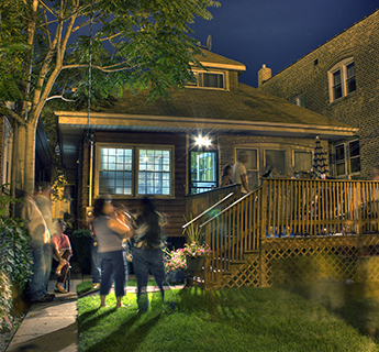
Built Form Regulations
The city of Minneapolis Is updating the zoning code to Reach Minneapolis 2040 Goals.
Minneapolis 2040 went into effect on January 1, 2020, following over two years of engagement with the people of Minneapolis. The plan guides growth and change with fourteen goals in mind, including eliminating racial disparities, slowing climate change, and increasing access to jobs and housing.
As required by state law, the City is beginning to change its zoning rules to match the development guidelines that the City Council already approved with Minneapolis 2040. This technical process will take several years and will include updating the zoning classification of every property in the city to match Minneapolis 2040.
The adoption of built form standards, regulating the scale of new buildings and additions throughout Minneapolis, is a critical step in the process of implementing the City’s comprehensive plan. The City Council voted to approve the built form regulations on December 18, 2020, after city staff received feedback from the City Planning Commission as well as various stakeholders throughout Minneapolis. These standards became effective on January 1, 2021. This website provides key features of the built form regulations and documents events that informed the updates to the zoning code. For more zoning code updates, visit the Code Development page on the City's website
Table of Contents
- Built Form Regulations
- Glossary
- Built Form Overlay District Handbook
- Built Form Overlay District Interactive Map
- Background
Built Form Regulations
Built Form Districts
The built form regulations will resolve some of the major conflicts between Minneapolis 2040 and the City’s current zoning regulations. They are also intended to provide more predictability for the scale of new buildings and additions, which will help achieve the Minneapolis 2040 goals.
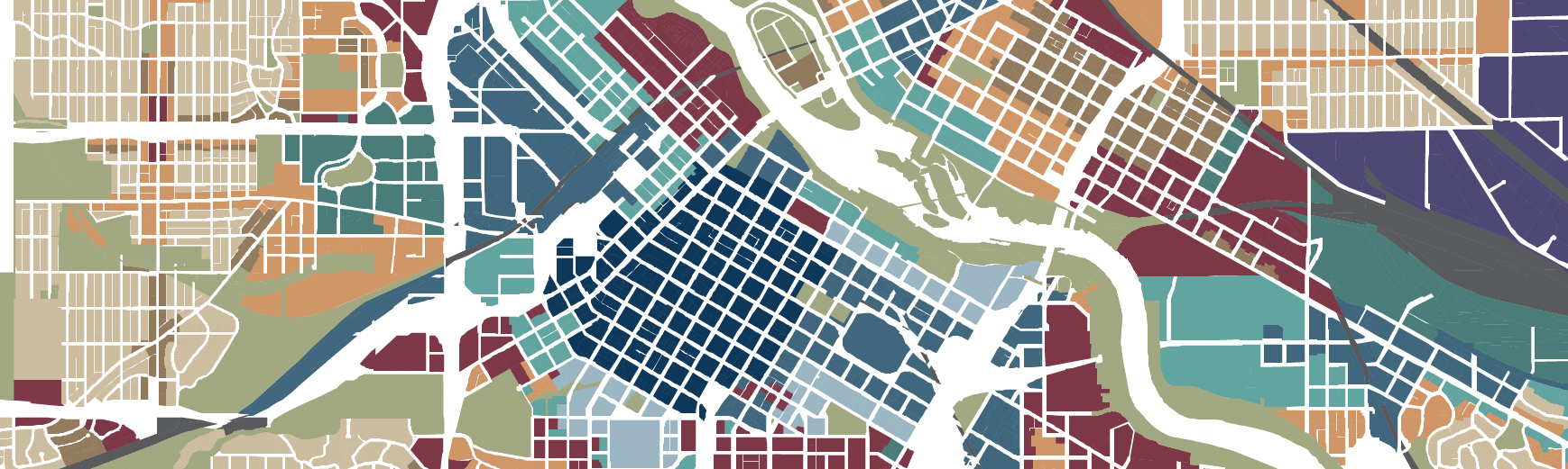
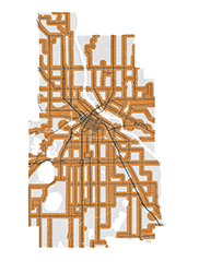
Minneapolis 2040 includes 14 Built Form Districts that guide the development of these regulations, which govern issues such as building height, floor area ratio (FAR), lot sizes and setbacks from property lines, among other things. (See Glossary below.) The zoning changes described here enact new overlay districts that contain built form regulations in accordance with the built form maps and policy guidance that was already adopted by the City Council in Minneapolis 2040.
Through a future rezoning study, the City will implement land use regulations to complement built form regulations. While built form regulations govern the scale of new buildings, land use regulations will govern allowed uses, such as mixed use, residential, commercial, production, parks and open spaces.
Important note: Not every property in the city will be redeveloped between now and 2040. These regulations will provide guidance if a property owner proposes changes to an existing building or proposes to construct a new building
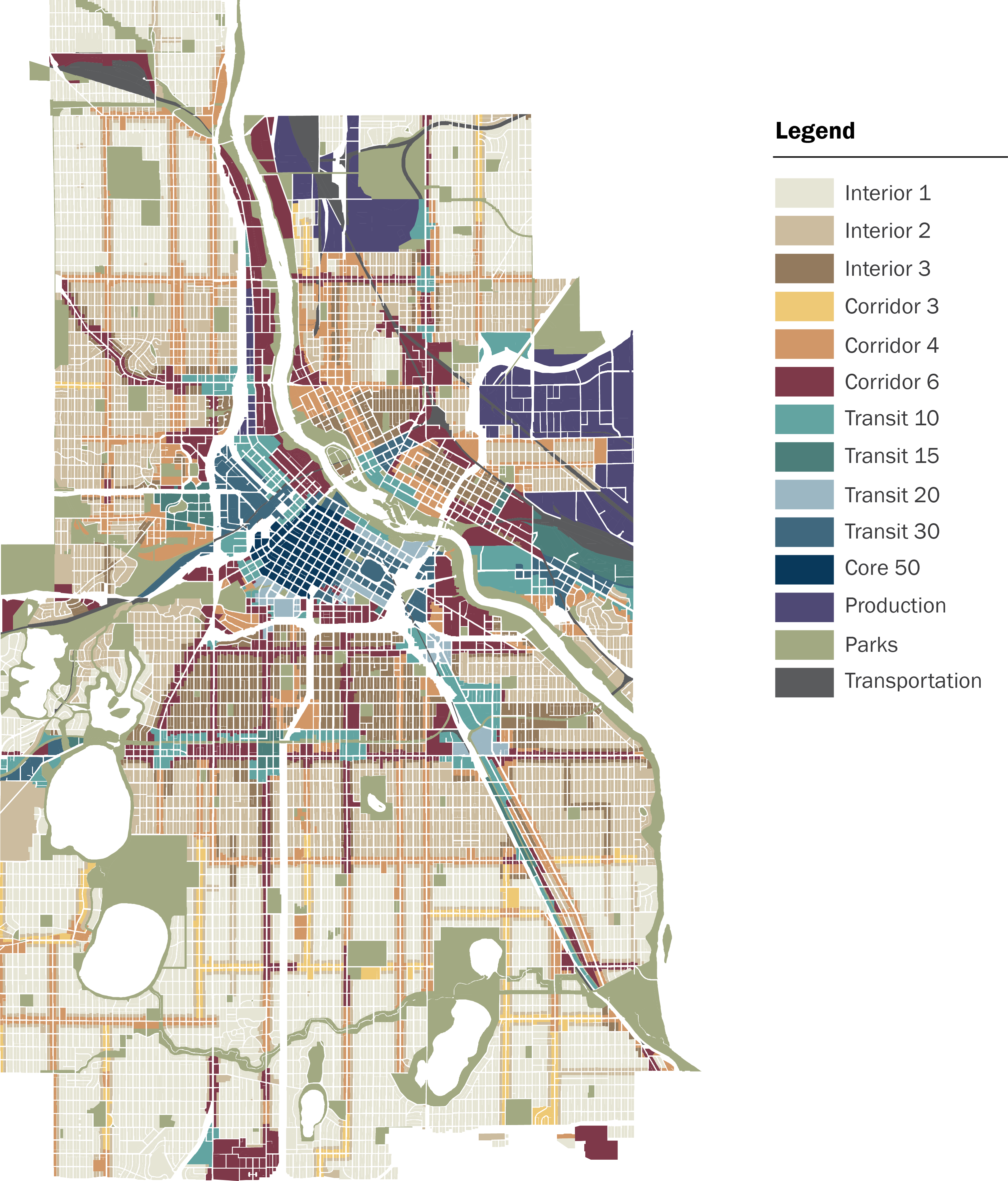
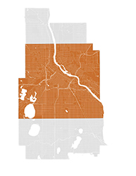
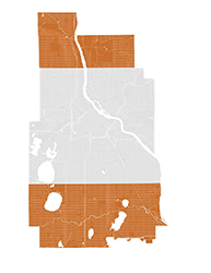
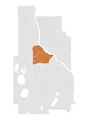
Built Form Map
GLOSSARY
Floor Area Ratio
Building Height
Premiums
Lot Dimensions
Lot Coverage and Impervious Surface
Setbacks
Mississippi River Corridor Critical Area (MRCCA)
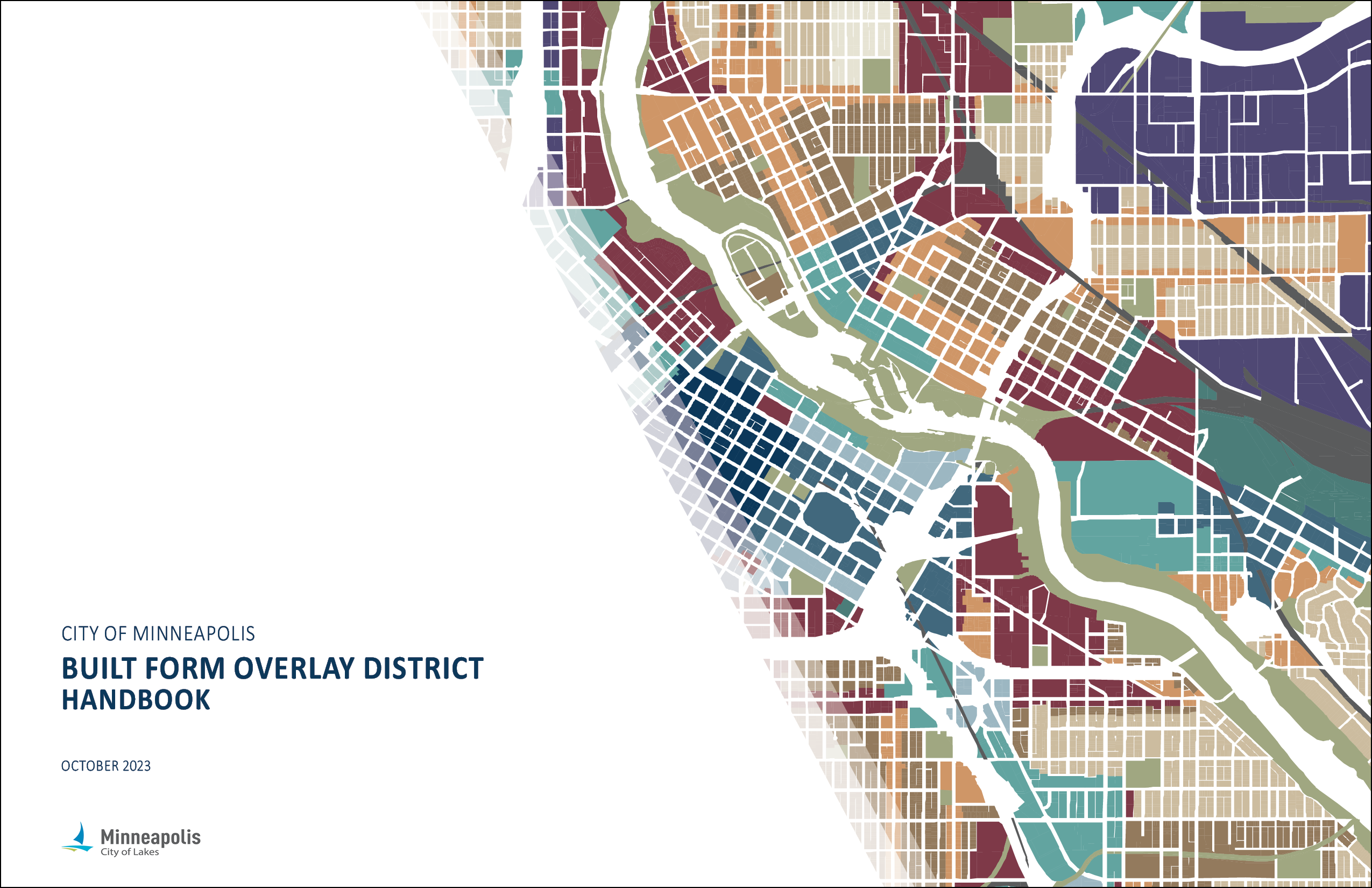
BUILT FORM OVERLAY DISTRICT HANDBOOK
The Built Form Overlay Districts handbook is a quick reference guide, but not necessarily a complete picture of all the City's built form regulations. It is still important to connect with a planner from the City of Minneapolis Department of Community Planning & Economic Development. These regulations are expected to increase the level of predictability in the development process for all stakeholders. Consistent with this higher level of predictability, fewer variances are expected to be requested and granted. Most of the built form regulations are found in a new Chapter 552, Built Form Overlay Districts. Each property in the City has a primary zoning district classification and a built form overlay district classification. The built form regulations do not change the allowed uses in the primary zoning district. A standard of the built form overlay districts can only be varied if section 552.520 of the zoning code includes an authorized variance for such standard. Note that a property may also be in another overlay district, in addition to a built form overlay district. City of Minneapolis Zoning Districts can be found on the City's Zoning Maps page.
Browse the entire Built Form Overlay District Handbook or browse by individual district in the carousel below.
Interior 1
Interior 2
Interior 3
Corridor 3
Corridor 4
Corridor 6
Transit 10
Transit 15
Transit 20
Transit 30
Core 50
Production
Parks
Premiums
BUILT FORM OVERLAY DISTRICT MAP
The Built Form Overlay District Map is part of the City’s zoning ordinance. This map matches the Future Built Form Map already approved by the City Council in Minneapolis 2040. It also includes additional districts near the Mississippi River that were adopted as part of the Mississippi River Corridor Critical Area Plan. Clicking on a district in the map will take you to a summary of the built form regulations for that district.
Background
Timeline
April 2016 - December 2018
Over two years of engagement on Minneapolis 2040
December 7, 2018
The City Council approved Minneapolis 2040
January 1, 2020
Minneapolis 2040 went into effect, along with initial zoning changes allowing up to three units on all residential properties and requiring a percentage of affordable housing units in new apartment buildings.
September 3, 2020
The public comment period began, with opportunities to review and comment on the draft built form regulations via this web site as well as three virtual meetings hosted by City staff.
September 23, 2020
City staff hosted virtual meeting #1.
- View YouTube video of recorded September 23, 2020 online open house: draft built form regulations
- View questions asked by participants in all three meetings, with answers provided by City staff.
September 29, 2020
City staff hosted virtual meeting #2.
- View YouTube video of recorded September 29, 2020 online open house: draft built form regulations
- View questions asked by participants in all three meetings, with answers provided by City staff.
October 21, 2020
City staff hosted virtual meeting #3.
- View YouTube video of recorded October 21, 2020 online open house: draft built form regulations (downtown focus)
- View questions asked by participants in all three meetings, with answers provided by City staff.
November 9, 2020
The public comment period closed with a public hearing before the City Planning Commission. The City Planning Commission voted to forward the built form regulations to the City Council, with amendments.
December 8, 2020
The Business, Inspections, Housing & Zoning (BIHZ) Committee of the City Council voted to forward the draft built form regulations to the full City Council, with amendments.
December 18, 2020
The City Council voted and approved the draft built form regulations.
January 1, 2021
The built form regulations went into effect.
Minneapolis 2040 Goals
The built form regulations are essential to achieving several goals of Minneapolis 2040, including accommodating more residents and jobs in the city, allowing a range of housing types and stabilizing housing costs, creating high quality physical environments, fostering complete neighborhoods and promoting climate change resilience.
While all the goals are important, Minneapolis 2040 is centered on eliminating racial disparities. To achieve this goal, the City of Minneapolis will work to undo the legacy that remains from racially discriminatory housing policies by increasing access to opportunity through a greater diversity of housing types, especially in areas that lack housing options as a result of discriminatory housing policy. Implementing the Built Form Map through zoning districts makes it legal to build the greater diversity of housing types called for in Minneapolis 2040, and will work in concert with the City’s larger housing strategy to increase housing choice and affordability.


Minneapolis 2040 Policies
The Land Use and Built Form section of Minneapolis 2040 describes where new housing, workplaces, and retail establishments may locate in the city in order to achieve the plan goals. This guidance is communicated through a combination of policies and maps. The first two policies of the plan, Access to Housing and Access to Employment, are the most relevant to the adopted Built Form Map that guides the location and characteristics of new buildings.
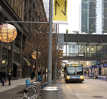
The Access to Housing policy outlines the role of the Built Form map in increasing housing choice throughout the city, acknowledging the contribution of zoning to racially-restrictive housing practices of the first half of the 20th century, and the lasting effect those actions had on people of color and indigenous people. The policy also reinforces the practice of developing multifamily housing on transit routes, providing people the opportunity to live without a car, or with fewer cars in each household, helping to work toward the City's greenhouse gas reduction goal. This policy ensures that we have places throughout the city to increase housing supply and choice.
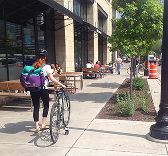
The Access to Employment policy outlines the role of the Built Form map in supporting employment growth and ensuring that land is available for living-wage jobs in areas close to where people live, including access to living-wage jobs.
Access to Housing
Access to Jobs